Geolocate

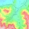
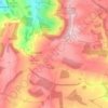
Nottingham Hill topographic map

Click on the map to display elevation.

About this map

Name: Nottingham Hill topographic map, elevation, terrain.

Location: Nottingham Hill, Tewkesbury, Gloucestershire, England, GL52 9AD, United Kingdom (51.95370 -2.02988 51.95380 -2.02978)

Average elevation: 515 ft

Minimum elevation: 190 ft

Maximum elevation: 974 ft

Other topographic maps

Click on a map to view its topography, its elevation and its terrain.
Winchcombe

United Kingdom > England > Gloucestershire > Tewkesbury

Average elevation: 515 ft

Tirley

United Kingdom > England > Gloucestershire > Tewkesbury

Average elevation: 62 ft

Snowshill

United Kingdom > England > Gloucestershire > Tewkesbury

Average elevation: 817 ft

Twigworth

United Kingdom > England > Gloucestershire > Tewkesbury

Average elevation: 46 ft

Prescott

United Kingdom > England > Gloucestershire > Tewkesbury

Average elevation: 486 ft

Highnam

United Kingdom > England > Gloucestershire > Tewkesbury > Highnam

Average elevation: 69 ft

Hawling

United Kingdom > England > Gloucestershire > Tewkesbury

Average elevation: 791 ft

Gear up for your next adventure:

🧥Men's Rain Shells - Premium waterproof and breathable jackets for mountain weather
🛠️Outdoor Gear Repair Kit - Essential tools to fix gear on the trail
🛏️Cold Weather Sleeping Bag - Warm sleeping bag for cold conditions
🪶Camping Sleeping Pad - Comfortable sleeping pad for backpacking
🪶Camp Gear Gift Set - Perfect gift bundle for outdoor fans

As an Amazon Associate, this site earns from qualifying purchases at no extra cost to you.