
紫溪镇 topographic map
Interactive map
Click on the map to display elevation.
About this map
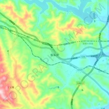
Name: 紫溪镇 topographic map, elevation, terrain.
Location: 紫溪镇, 楚雄市, 楚雄彝族自治州, 云南省, 中国 (25.04899 101.41520 25.12899 101.49520)
Average elevation: 6,240 ft
Minimum elevation: 5,856 ft
Maximum elevation: 7,100 ft
Other topographic maps
Click on a map to view its topography, its elevation and its terrain.