Geolocate

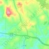
Postelle topographic map

Click on the map to display elevation.

About this map

Name: Postelle topographic map, elevation, terrain.

Location: Postelle, Polk County, East Tennessee, Tennessee, 37317, United States (35.02425 -84.42409 35.06425 -84.38409)

Average elevation: 1,667 ft

Minimum elevation: 1,421 ft

Maximum elevation: 2,290 ft

Polk County trails, hiking, mountain biking, running and outdoor activities

Other topographic maps

Click on a map to view its topography, its elevation and its terrain.
Copperhill

United States > Tennessee > Polk County

Average elevation: 1,621 ft

Ducktown

United States > Tennessee > Polk County

Average elevation: 1,686 ft

Benton

United States > Tennessee > Polk County

Average elevation: 797 ft

Copperhill

United States > Tennessee > Polk County

Average elevation: 1,617 ft

Ducktown

United States > Tennessee > Polk County

Average elevation: 1,686 ft

Gear up for your next adventure:

📦Gear Storage Bags - Organize and protect outdoor equipment
🧤Tactile Hiking Gloves - Keep hands warm while operating GPS and smartphone screens
🧦Merino Wool Socks - Moisture-wicking, blister-preventing socks for long treks
🔪Outdoor Multitools - Essential survival tools for gear repair and field use
🧭Pro Hiking Compasses - High-accuracy liquid-filled compasses for topographic orientation

As an Amazon Associate, this site earns from qualifying purchases at no extra cost to you.