Geolocate

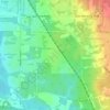
Springfield Township topographic map

Click on the map to display elevation.

About this map

Name: Springfield Township topographic map, elevation, terrain.

Location: Springfield Township, Summit County, Ohio, United States (40.98815 -81.49237 41.06677 -81.39296)

Average elevation: 1,125 ft

Minimum elevation: 1,010 ft

Maximum elevation: 1,263 ft

Other topographic maps

Click on a map to view its topography, its elevation and its terrain.

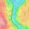
Mud Brook Falls

United States > Ohio > Summit County > Cuyahoga Falls

Average elevation: 1,004 ft

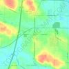
Boston

United States > Ohio > Summit County

Average elevation: 804 ft

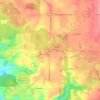
Greensburg

United States > Ohio > Summit County > Green

Average elevation: 1,175 ft

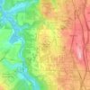
Six Corners

United States > Ohio > Summit County > Tallmadge

Average elevation: 1,148 ft

Metz

United States > Ohio > Summit County > Stow

Average elevation: 1,043 ft

Little Cuyahoga River

United States > Ohio > Summit County > Akron

Average elevation: 948 ft

Copley

United States > Ohio > Summit County

Average elevation: 1,043 ft

North Springfield

United States > Ohio > Summit County > Akron

Average elevation: 1,102 ft

Copley

United States > Ohio > Summit County

Average elevation: 1,043 ft

Copley

United States > Ohio > Summit County

Average elevation: 1,043 ft

Sagamore Hills

United States > Ohio > Summit County

Average elevation: 866 ft

Maple Grove Park

United States > Ohio > Summit County > Hudson

Average elevation: 1,037 ft

Gear up for your next adventure:

🥾Hiking Shoes - Durable and comfortable shoes for trail hiking
💧Water Purification System - Clean water on the trail with reliable purifiers
🚑Emergency Bivvies - Heat-reflective sleeping bags for survival situations
🌧️Backpack Rain Cover - Keep gear dry in wet weather
⛺Backpacking Tent - Lightweight and durable tent for multi‑day hikes

As an Amazon Associate, this site earns from qualifying purchases at no extra cost to you.