Geolocate

Elliston topographic map

Click on the map to display elevation.

About this map

Name: Elliston topographic map, elevation, terrain.

Location: Elliston, Newfoundland, Newfoundland and Labrador, A0C 1N0, Canada (48.60868 -53.05358 48.64868 -53.01358)

Average elevation: 108 ft

Minimum elevation: -3 ft

Maximum elevation: 476 ft

Other topographic maps

Click on a map to view its topography, its elevation and its terrain.
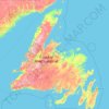
Newfoundland

Canada > Newfoundland and Labrador > Elliston

Average elevation: 269 ft

Gear up for your next adventure:

📶Vehicle Signal Boosters - Improve reception in rural areas while driving to trailheads
🔭Stargazing Telescopes - Perfect for camping in low-light pollution areas shown on maps
🔥Camping Stove - Portable stove for camping and backcountry cooking
🥾Women's Hiking Boots - Top-rated trail boots with ankle support and superior grip
🔭Telescopic Hiking Pole - Adjustable pole for hiking stability

As an Amazon Associate, this site earns from qualifying purchases at no extra cost to you.