Geolocate

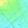
Cabalantian topographic map

Click on the map to display elevation.

About this map

Name: Cabalantian topographic map, elevation, terrain.

Location: Cabalantian, Bacolor, Pampanga, Central Luzon, 2001, Philippines (14.99001 120.64649 15.02698 120.69641)

Average elevation: 26 ft

Minimum elevation: 7 ft

Maximum elevation: 62 ft

Other topographic maps

Click on a map to view its topography, its elevation and its terrain.

Talba

Philippines > Pampanga > Bacolor

Average elevation: 20 ft

Parulog

Philippines > Pampanga > Bacolor

Average elevation: 39 ft

San Antonio

Philippines > Pampanga > Bacolor

Average elevation: 59 ft

Santa Ines

Philippines > Pampanga > Bacolor

Average elevation: 26 ft

Potrero

Philippines > Pampanga > Bacolor

Average elevation: 125 ft

Parulog

Philippines > Pampanga > Bacolor

Average elevation: 39 ft

San Antonio

Philippines > Pampanga > Bacolor

Average elevation: 59 ft

Santa Ines

Philippines > Pampanga > Bacolor

Average elevation: 26 ft

Parulog

Philippines > Pampanga > Bacolor

Average elevation: 39 ft

Gear up for your next adventure:

🚪Portable Camp Chair - Foldable chair for comfort at camp
🔊Portable Camp Speaker - Music and alerts at camp
💧Water Filtration Bottles - Safely drink from streams and lakes while exploring
😴Insulated Sleeping Pads - Compact and warm pads for high-elevation camping
📱Heavy-Duty Phone Cases - Drop-proof and waterproof protection for outdoor navigation

As an Amazon Associate, this site earns from qualifying purchases at no extra cost to you.