Geolocate

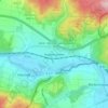
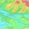
37130 topographic map

Click on the map to display elevation.

About this map

Name: 37130 topographic map, elevation, terrain.

Location: 37130, Gelliehausen, Gleichen, Landkreis Göttingen, Lower Saxony, Germany (51.41719 9.93413 51.53555 10.18605)

Average elevation: 902 ft

Minimum elevation: 502 ft

Maximum elevation: 1,434 ft

Other topographic maps

Click on a map to view its topography, its elevation and its terrain.

Sieber

Germany > Lower Saxony > Landkreis Göttingen > Herzberg

Average elevation: 1,650 ft

Abt. 49A

Germany > Lower Saxony > Landkreis Göttingen > Göttingen

Average elevation: 509 ft

Gear up for your next adventure:

🗃️Trail First Aid Kit - Essential kit for outdoor injuries and emergencies
⌚Solar GPS Watches - Advanced multisport watches with built-in topographic maps
🎒Day Hiking Backpack - Lightweight backpack perfect for day trips and outdoor adventures
🦺Reflective Outdoor Gear - Safety gear for low‑light conditions
🕶️GPS Smartphone Mount - Secure mount for phone navigation

As an Amazon Associate, this site earns from qualifying purchases at no extra cost to you.