Geolocate

Oegstgeest topographic map

Click on the map to display elevation.

About this map

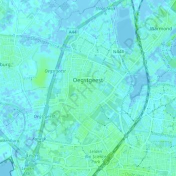
Name: Oegstgeest topographic map, elevation, terrain.

Location: Oegstgeest, South Holland, Netherlands (52.16205 4.43495 52.20480 4.49759)

Average elevation: 7 ft

Minimum elevation: -13 ft

Maximum elevation: 20 ft

Other topographic maps

Click on a map to view its topography, its elevation and its terrain.

Botlek

Netherlands > South Holland

Average elevation: 10 ft

Meije

Netherlands > South Holland > Nieuwkoop

Average elevation: -7 ft

Langeraar

Netherlands > South Holland

Average elevation: -10 ft

Broekhuizen

Netherlands > South Holland > Gouda

Average elevation: -3 ft

Ankerpark

Netherlands > South Holland > Leiden

Average elevation: 10 ft

Middelsluis

Netherlands > South Holland > Numansdorp

Average elevation: 0 ft

Weerestein

Netherlands > South Holland > Hillegom

Average elevation: 0 ft

Weerestein

Netherlands > South Holland > Hillegom

Average elevation: 0 ft

Meijendel

Netherlands > South Holland > Wassenaar

Average elevation: 20 ft

Coepelduynen

Netherlands > South Holland > Katwijk

Average elevation: 13 ft

Het Park

Netherlands > South Holland > Rotterdam

Average elevation: 13 ft

Waalhaven

Netherlands > South Holland > Rotterdam

Average elevation: 10 ft

Gear up for your next adventure:

🪶LED Camping Lantern - Bright lantern for camp lighting
🪶Multi‑Purpose Knife - Useful blade for camp and trail
🧼Biodegradable Camping Soap - Eco‑friendly soap for outdoor hygiene
🗃️Trail First Aid Kit - Essential kit for outdoor injuries and emergencies
🧦Hiking Socks - Comfortable socks to prevent blisters on long hikes

As an Amazon Associate, this site earns from qualifying purchases at no extra cost to you.