Geolocate

Gap topographic map

Click on the map to display elevation.

About this map

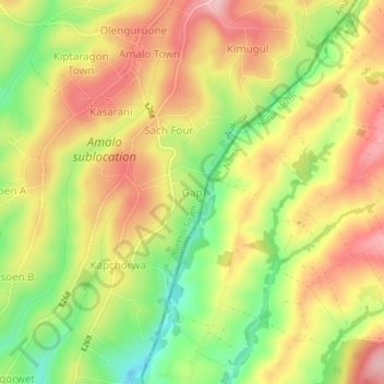
Name: Gap topographic map, elevation, terrain.

Location: Gap, Amalo ward, Kuresoi South, Nakuru, Rift Valley, Kenya (-0.62438 35.67163 -0.58438 35.71163)

Average elevation: 8,225 ft

Minimum elevation: 7,913 ft

Maximum elevation: 8,491 ft

Gear up for your next adventure:

❄️Traction Cleats - Prevent slips on icy trails during winter hikes
🧼Biodegradable Camping Soap - Eco‑friendly soap for outdoor hygiene
📦Gear Storage Bags - Organize and protect outdoor equipment
🎒Trail Energy Bars - High‑calorie bars for hiking energy
🧥Men's Rain Shells - Premium waterproof and breathable jackets for mountain weather

As an Amazon Associate, this site earns from qualifying purchases at no extra cost to you.