
Make a donation
Gear up for your next adventure:
As an Amazon Associate, this site earns from qualifying purchases at no extra cost to you.
1st Vermilion Lake topographic map
Click on the map to display elevation.
Make a donation
Gear up for your next adventure:
As an Amazon Associate, this site earns from qualifying purchases at no extra cost to you.
About this map
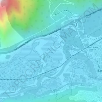
Name: 1st Vermilion Lake topographic map, elevation, terrain.
Average elevation: 4,774 ft
Minimum elevation: 4,505 ft
Maximum elevation: 7,310 ft
Make a donation
Gear up for your next adventure:
As an Amazon Associate, this site earns from qualifying purchases at no extra cost to you.
Other topographic maps
Click on a map to view its topography, its elevation and its terrain.
Mount Rundle
Canada > Alberta > Improvement District No. 9
In Banff, the Spray River trailhead for the first peak taking the Mount Rundle Trail, is near the Spray River bridge on the road to the Banff Springs Golf Course. The all-day hike (from 8–10 hours) from the trailhead to the peak is about 5 kilometres (3.1 mi) one-way and has an elevation gain of about 993…
Average elevation: 7,720 ft
Make a donation
Gear up for your next adventure:
As an Amazon Associate, this site earns from qualifying purchases at no extra cost to you.
Kootenay National Park
Canada > Alberta > Improvement District No. 9
Kootenay National Park is a national park of Canada located in southeastern British Columbia. The park consists of 1,406 km2 (543 sq mi) of the Canadian Rockies, including parts of the Kootenay and Park mountain ranges, the Kootenay River and the entirety of the Vermilion River. While the Vermilion River is…
Average elevation: 6,014 ft