Geolocate

Edmonton topographic map

Click on the map to display elevation.

About this map

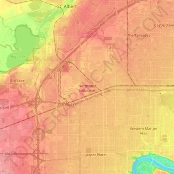
Name: Edmonton topographic map, elevation, terrain.

Location: Northwest Industrial, Edmonton, Alberta, Canada (53.53678 -113.71384 53.62873 -113.53108)

Average elevation: 2,221 ft

Minimum elevation: 2,014 ft

Maximum elevation: 2,326 ft

Other topographic maps

Click on a map to view its topography, its elevation and its terrain.

William Hawrelak Park

Canada > Alberta > Edmonton

Average elevation: 2,129 ft

Horseshoe Lake

Canada > Alberta > Edmonton

Average elevation: 2,231 ft

landslide

Canada > Alberta > Edmonton

Average elevation: 2,192 ft

Ormsby Park

Canada > Alberta > Edmonton

Average elevation: 2,257 ft

Gear up for your next adventure:

🥄Camping Utensil Set - Lightweight utensils for outdoor meals
🥾Hiking Shoes - Durable and comfortable shoes for trail hiking
🧣Merino Neck Gaiters - Multi-functional headwear for wind and sun protection
🎒Day Hiking Backpack - Lightweight backpack perfect for day trips and outdoor adventures
🚑Emergency Bivvies - Heat-reflective sleeping bags for survival situations

As an Amazon Associate, this site earns from qualifying purchases at no extra cost to you.