
Warren topographic map
Click on the map to display elevation.
About this map
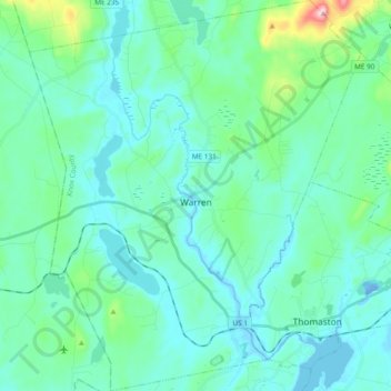
Name: Warren topographic map, elevation, terrain.
Location: Warren, Knox County, Maine, 04864, United States (44.05478 -69.32153 44.19097 -69.16055)
Average elevation: 154 ft
Minimum elevation: -56 ft
Maximum elevation: 1,033 ft
Knox County trails, hiking, mountain biking, running and outdoor activities
Other topographic maps
Click on a map to view its topography, its elevation and its terrain.
Matinicus Island
United States > Maine > Knox County > Matinicus Isle Plantation
Matinicus Isle plantation is an archipelago located on the southeastern fringes of Penobscot Bay in the Gulf of Maine, part of the Atlantic Ocean. According to the United States Census Bureau, the plantation has a total area of 9.9 square miles (26 km2), of which 2.3 square miles (6.0 km2) is land and 7.6…
Average elevation: 16 ft