
Leiria topographic map
Interactive map
Click on the map to display elevation.
About this map
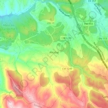
Name: Leiria topographic map, elevation, terrain.
Location: Leiria, Arrabal, Leiria, 2420-020 ARRABAL, Portugal (39.67008 -8.75990 39.72756 -8.70416)
Average elevation: 732 ft
Minimum elevation: 256 ft
Maximum elevation: 1,421 ft
Other topographic maps
Click on a map to view its topography, its elevation and its terrain.