Geolocate

Paige topographic map

Click on the map to display elevation.

About this map

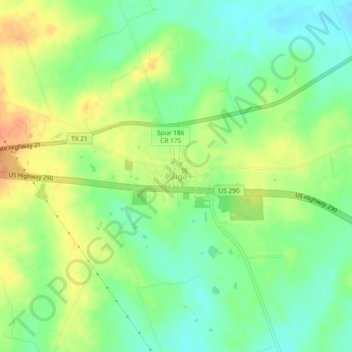
Name: Paige topographic map, elevation, terrain.

Location: Paige, Bastrop County, Texas, United States (30.19165 -97.13328 30.23165 -97.09328)

Average elevation: 528 ft

Minimum elevation: 466 ft

Maximum elevation: 600 ft

Bastrop County trails, hiking, mountain biking, running and outdoor activities

Other topographic maps

Click on a map to view its topography, its elevation and its terrain.

Cedar Creek

United States > Texas > Bastrop County

Average elevation: 410 ft

Smithville

United States > Texas > Bastrop County

Average elevation: 328 ft

Smithville

United States > Texas > Bastrop County

Average elevation: 328 ft

Bastrop

United States > Texas > Bastrop County

Average elevation: 423 ft

Line Creek

United States > Texas > Bastrop County

Average elevation: 427 ft

Smithville

United States > Texas > Bastrop County

Average elevation: 328 ft

Gear up for your next adventure:

😴Insulated Sleeping Pads - Compact and warm pads for high-elevation camping
🌎3D Topographic Globes - Raised relief globes for a tactile understanding of geography
🧭Pro Hiking Compasses - High-accuracy liquid-filled compasses for topographic orientation
🪵Folding Camp Saw - Compact saw for wood and campsite work
🎒Hydration Pack - Hands‑free water reservoir for long hikes

As an Amazon Associate, this site earns from qualifying purchases at no extra cost to you.