Geolocate

Mohave Valley topographic map

Click on the map to display elevation.

About this map

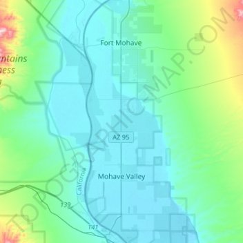
Name: Mohave Valley topographic map, elevation, terrain.

Location: Mohave Valley, Mohave County, Arizona, United States (34.84059 -114.63671 35.04430 -114.52035)

Average elevation: 758 ft

Minimum elevation: 459 ft

Maximum elevation: 3,150 ft

Mohave County trails, hiking, mountain biking, running and outdoor activities

Gear up for your next adventure:

🔦LED Headlamp - Bright and durable LED headlamp for night navigation
🧭Compass with Lanyard - Easy‑carry compass for navigation
🦶Hiking Gaiters - Keep debris and water out of your boots
🔋Solar Power Banks - Keep your GPS and phone charged in remote wilderness areas
🧼Biodegradable Camping Soap - Eco‑friendly soap for outdoor hygiene

As an Amazon Associate, this site earns from qualifying purchases at no extra cost to you.