Geolocate

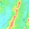
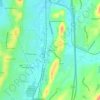
Pelham topographic map

Click on the map to display elevation.

About this map

Name: Pelham topographic map, elevation, terrain.

Location: Pelham, Shelby County, Alabama, United States (33.24289 -86.83075 33.38996 -86.66577)

Average elevation: 568 ft

Minimum elevation: 253 ft

Maximum elevation: 1,230 ft

Shelby County trails, hiking, mountain biking, running and outdoor activities

Other topographic maps

Click on a map to view its topography, its elevation and its terrain.
Scottsdale

United States > Alabama > Shelby County > Alabaster

Average elevation: 551 ft

Valley Forge

United States > Alabama > Shelby County > Alabaster

Average elevation: 499 ft

Maylene

United States > Alabama > Shelby County > Alabaster

Average elevation: 587 ft

Meadowbrook

United States > Alabama > Shelby County

Average elevation: 630 ft

Chandalar South

United States > Alabama > Shelby County > Pelham

Average elevation: 525 ft

Abbot Springs

United States > Alabama > Shelby County > Westover

Average elevation: 535 ft

Lawley

United States > Alabama > Shelby County

Average elevation: 551 ft

Lake Purdy

United States > Alabama > Shelby County > Brook Highland

Average elevation: 614 ft

Indian Shoals

United States > Alabama > Shelby County > Wilsonville

Average elevation: 433 ft

Westover

United States > Alabama > Shelby County

Average elevation: 502 ft

Hardy

United States > Alabama > Shelby County > Alabaster

Average elevation: 515 ft

Meadowbrook

United States > Alabama > Shelby County > Meadowbrook

Average elevation: 630 ft

Gear up for your next adventure:

🥄Camping Utensil Set - Lightweight utensils for outdoor meals
🗺️Topographic Maps - Detailed topo maps for hiking, exploring and outdoor navigation
🏔️Mountain Trail Maps - High‑detail maps for popular peaks
🧦Merino Wool Socks - Moisture-wicking, blister-preventing socks for long treks
⛑️Personal Locator Beacon - Safety beacon for emergencies

As an Amazon Associate, this site earns from qualifying purchases at no extra cost to you.