
Tillman topographic map
Click on the map to display elevation.
About this map
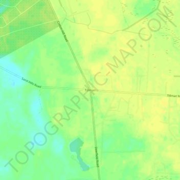
Name: Tillman topographic map, elevation, terrain.
Location: Tillman, Jasper County, South Carolina, 29943, United States (32.44352 -81.12733 32.48352 -81.08733)
Average elevation: 49 ft
Minimum elevation: 7 ft
Maximum elevation: 69 ft
Jasper County trails, hiking, mountain biking, running and outdoor activities
Other topographic maps
Click on a map to view its topography, its elevation and its terrain.
Hardeeville
United States > South Carolina > Jasper County
The city is located on the Atlantic coastal plain, with very few variations in elevation. The average elevation of the city is approximately 20 feet (6.1 m) above mean sea level. Most of Hardeeville is located within Jasper County, though a small portion of the city crosses into Beaufort County. Much of the…
Average elevation: 16 ft
Ridgeland
United States > South Carolina > Jasper County
Ridgeland is in northeastern Jasper County, with the center of town sitting on a low ridge at an elevation of 62 feet (19 m) above sea level. According to the United States Census Bureau, the town has a total area of 44.7 square miles (115.8 km2), of which 44.4 square miles (115.1 km2) are land and 0.3 square…
Average elevation: 49 ft
Hardeeville
United States > South Carolina > Jasper County
The city is located on the Atlantic coastal plain, with very few variations in elevation. The average elevation of the city is approximately 20 feet (6.1 m) above mean sea level. Most of Hardeeville is located within Jasper County, though a small portion of the city crosses into Beaufort County. Much of the…
Average elevation: 16 ft