Geolocate

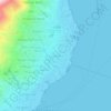
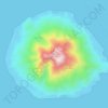
Pulau Ternate topographic map

Click on the map to display elevation.

About this map

Name: Pulau Ternate topographic map, elevation, terrain.

Location: Pulau Ternate, Ternate, North Maluku, Maluku, Indonesia (0.75298 127.29283 0.86775 127.39153)

Average elevation: 705 ft

Minimum elevation: -3 ft

Maximum elevation: 5,591 ft

Other topographic maps

Click on a map to view its topography, its elevation and its terrain.

Pulau Hiri

Indonesia > North Maluku > Ternate > Dorari Isa

Average elevation: 354 ft

Kota Baru

Indonesia > North Maluku > Ternate

Average elevation: 144 ft

Moti Island

Indonesia > North Maluku > Ternate

Average elevation: 479 ft

Gamalama

Indonesia > North Maluku > Ternate > Gamalama

Average elevation: 253 ft

Gear up for your next adventure:

🪶Compact Camp Shovel - Folding shovel for campsite tasks
👟Trail Running Shoes - Lightweight shoes for trail runners
🧭GPS Watch Accessories - Bands and chargers for GPS watches
🧭Compass with Lanyard - Easy‑carry compass for navigation
🩳Quick‑Dry Hiking Shorts - Comfortable and quick‑dry shorts for summer hiking

As an Amazon Associate, this site earns from qualifying purchases at no extra cost to you.