Geolocate

Tingwick topographic map

Click on the map to display elevation.

About this map

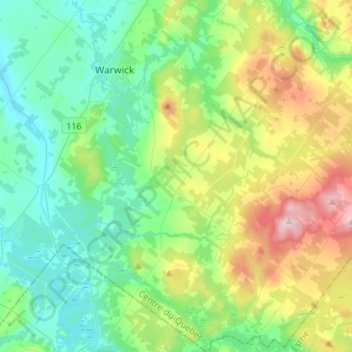
Name: Tingwick topographic map, elevation, terrain.

Location: Tingwick, Arthabaska, Centre-du-Québec, Quebec, Canada (45.79634 -72.02532 45.98261 -71.82771)

Average elevation: 679 ft

Minimum elevation: 344 ft

Maximum elevation: 1,552 ft

Gear up for your next adventure:

🧢Sun Protection Hats - Wide-brimmed and UPF-rated hats for high-altitude sun safety
🕶️GPS Smartphone Mount - Secure mount for phone navigation
🦶Carbon Trekking Poles - Reduce knee impact on steep descents with ultra-light poles
🔦LED Headlamp - Bright and durable LED headlamp for night navigation
🎒Hydration Pack - Hands‑free water reservoir for long hikes

As an Amazon Associate, this site earns from qualifying purchases at no extra cost to you.