Geolocate

Bhotechaur topographic map

Click on the map to display elevation.

About this map

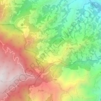
Name: Bhotechaur topographic map, elevation, terrain.

Location: Bhotechaur, Melamchi, Sindhupalchowk, Bagamati Province, Nepal (27.77062 85.47444 27.81062 85.51444)

Average elevation: 5,453 ft

Minimum elevation: 3,314 ft

Maximum elevation: 7,795 ft

Other topographic maps

Click on a map to view its topography, its elevation and its terrain.

Balephi Khola

Nepal > Bagamati Province > Sindhupalchowk

Average elevation: 8,068 ft

Sunkoshi

Nepal > Bagamati Province > Sindhupalchowk

Average elevation: 4,521 ft

Gear up for your next adventure:

☀️Outdoor Sunscreen - High protection sunscreen for outdoor activities
🧤Hiking Gloves - Protective gloves for rugged trails
🧭Compass with Lanyard - Easy‑carry compass for navigation
🏫Relief Map Kits - Hands-on tools for teaching landforms and elevation
🦶Carbon Trekking Poles - Reduce knee impact on steep descents with ultra-light poles

As an Amazon Associate, this site earns from qualifying purchases at no extra cost to you.