Geolocate

Dudley topographic map

Click on the map to display elevation.

About this map

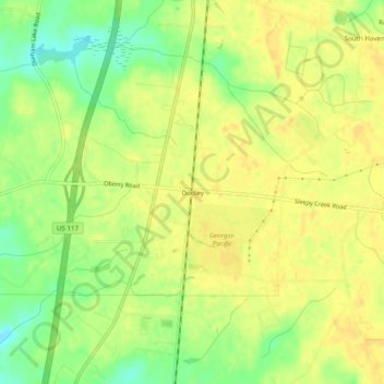
Name: Dudley topographic map, elevation, terrain.

Location: Dudley, Wayne County, North Carolina, 28333, United States (35.24739 -78.05749 35.28739 -78.01749)

Average elevation: 174 ft

Minimum elevation: 115 ft

Maximum elevation: 200 ft

Other topographic maps

Click on a map to view its topography, its elevation and its terrain.

Goldsboro

United States > North Carolina > Wayne County

Average elevation: 108 ft

Elroy

United States > North Carolina > Wayne County

Average elevation: 98 ft

Goldsboro

United States > North Carolina > Wayne County

Average elevation: 108 ft

Gear up for your next adventure:

🧭GPS Watch Accessories - Bands and chargers for GPS watches
🏫Relief Map Kits - Hands-on tools for teaching landforms and elevation
🔌USB Car Charger - Car charger for on‑the‑go power needs
🪶Trail Camera - Capture wildlife on your hikes
🪶LED Camping Lantern - Bright lantern for camp lighting

As an Amazon Associate, this site earns from qualifying purchases at no extra cost to you.