Geolocate

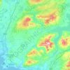
Slievecallan topographic map

Click on the map to display elevation.

About this map

Name: Slievecallan topographic map, elevation, terrain.

Location: Slievecallan, West Clare Municipal District, County Clare, Munster, Ireland (52.84067 -9.27077 52.84077 -9.27067)

Average elevation: 869 ft

Minimum elevation: 367 ft

Maximum elevation: 1,273 ft

Other topographic maps

Click on a map to view its topography, its elevation and its terrain.

Lahinch

Ireland > County Clare

Average elevation: 115 ft

Killaloe

Ireland > County Clare > Killaloe

Average elevation: 190 ft

Kilfenora

Ireland > County Clare

Average elevation: 230 ft

Corofin

Ireland > County Clare

Average elevation: 79 ft

Clooney

Ireland > County Clare

Average elevation: 187 ft

Doonass

Ireland > County Clare

Average elevation: 92 ft

Mountallon

Ireland > County Clare

Average elevation: 105 ft

Gear up for your next adventure:

🕶️GPS Smartphone Mount - Secure mount for phone navigation
🧣Merino Neck Gaiters - Multi-functional headwear for wind and sun protection
🖼️Topo Map Wall Art - Decorative topographic prints of famous peaks and regions
🔭Telescopic Hiking Pole - Adjustable pole for hiking stability
📶Satellite Messenger - Communication device off‑grid

As an Amazon Associate, this site earns from qualifying purchases at no extra cost to you.