Geolocate

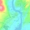
Kilfenora topographic map

Click on the map to display elevation.

About this map

Name: Kilfenora topographic map, elevation, terrain.

Location: Kilfenora, Kilfenora ED, West Clare Municipal District, County Clare, Munster, Ireland (52.97258 -9.22445 52.99453 -9.19895)

Average elevation: 230 ft

Minimum elevation: 151 ft

Maximum elevation: 466 ft

Other topographic maps

Click on a map to view its topography, its elevation and its terrain.
Killaloe

Ireland > County Clare > Killaloe

Average elevation: 190 ft

Doonbeg

Ireland > County Clare

Average elevation: 36 ft

Turlough Hill

Ireland > County Clare

Average elevation: 423 ft

Corkscrew Hill

Ireland > County Clare

Average elevation: 551 ft

Connolly

Ireland > County Clare

Average elevation: 315 ft

Fitz's Cross

Ireland > County Clare

Average elevation: 174 ft

Roadford

Ireland > County Clare > Fitz's Cross

Average elevation: 154 ft

Slievecallan

Ireland > County Clare

Average elevation: 869 ft

Carrigaholt

Ireland > County Clare

Average elevation: 36 ft

Black Head (Clare)

Ireland > County Clare

Average elevation: 131 ft

Gear up for your next adventure:

🪄Magnetic Compass - Accurate compass for navigation
🌧️Backpack Rain Cover - Keep gear dry in wet weather
🌐World Map Poster - Decorative world maps with topographic info
🧭Orienteering Set - Complete compass and map reading kit
🪶Camping Sleeping Pad - Comfortable sleeping pad for backpacking

As an Amazon Associate, this site earns from qualifying purchases at no extra cost to you.