Geolocate

Atlas topographic map

Click on the map to display elevation.

About this map

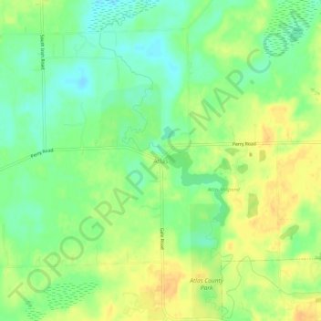
Name: Atlas topographic map, elevation, terrain.

Location: Atlas, Genesee County, Michigan, 48411, United States (42.91781 -83.55439 42.95781 -83.51439)

Average elevation: 860 ft

Minimum elevation: 807 ft

Maximum elevation: 906 ft

Genesee County trails, hiking, mountain biking, running and outdoor activities

Other topographic maps

Click on a map to view its topography, its elevation and its terrain.

Otter Lake

United States > Michigan > Genesee County

Average elevation: 863 ft

Montrose

United States > Michigan > Genesee County

Average elevation: 666 ft

Lake Fenton

United States > Michigan > Genesee County

Average elevation: 883 ft

Goodrich

United States > Michigan > Genesee County

Average elevation: 889 ft

Atlas County Park

United States > Michigan > Genesee County > Atlas

Average elevation: 873 ft

Beecher

United States > Michigan > Genesee County

Average elevation: 778 ft

Mount Morris

United States > Michigan > Genesee County

Average elevation: 778 ft

Gaines

United States > Michigan > Genesee County

Average elevation: 846 ft

Lennon

United States > Michigan > Genesee County

Average elevation: 771 ft

Otisville

United States > Michigan > Genesee County

Average elevation: 814 ft

Seely Lake

United States > Michigan > Genesee County

Average elevation: 863 ft

Gear up for your next adventure:

🧦Hiking Socks - Comfortable socks to prevent blisters on long hikes
🪶Wildlife Field Guides - Learn animal tracking and species ID
🪶Thermal Camp Blanket - Extra warmth for cold nights
🕶️Glacier Sunglasses - Side shields to protect eyes from high-altitude snow glare
🔦LED Headlamp - Bright and durable LED headlamp for night navigation

As an Amazon Associate, this site earns from qualifying purchases at no extra cost to you.