Geolocate

Mount Morris topographic map

Click on the map to display elevation.

About this map

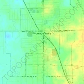
Name: Mount Morris topographic map, elevation, terrain.

Location: Mount Morris, Genesee County, Michigan, 48458, United States (43.10477 -83.71102 43.12689 -83.68726)

Average elevation: 778 ft

Minimum elevation: 741 ft

Maximum elevation: 810 ft

Genesee County trails, hiking, mountain biking, running and outdoor activities

Other topographic maps

Click on a map to view its topography, its elevation and its terrain.

Russellville

United States > Michigan > Genesee County

Average elevation: 764 ft

Bayport Park

United States > Michigan > Genesee County

Average elevation: 883 ft

Brent Creek

United States > Michigan > Genesee County

Average elevation: 686 ft

Duffield

United States > Michigan > Genesee County

Average elevation: 787 ft

Farrandville

United States > Michigan > Genesee County

Average elevation: 719 ft

Lakeside

United States > Michigan > Genesee County

Average elevation: 879 ft

Pine Run

United States > Michigan > Genesee County

Average elevation: 741 ft

Rankin

United States > Michigan > Genesee County

Average elevation: 823 ft

Richfield Center

United States > Michigan > Genesee County

Average elevation: 787 ft

Rogersville

United States > Michigan > Genesee County

Average elevation: 761 ft

Thetford Center

United States > Michigan > Genesee County

Average elevation: 791 ft

Atlas

United States > Michigan > Genesee County

Average elevation: 860 ft

Atlas County Park

United States > Michigan > Genesee County > Atlas

Average elevation: 873 ft

Otter Lake

United States > Michigan > Genesee County

Average elevation: 863 ft

Seely Lake

United States > Michigan > Genesee County

Average elevation: 863 ft

Gear up for your next adventure:

🎁Geography Themed Gifts - Unique gift ideas for map lovers and geography enthusiasts
🩳Quick‑Dry Hiking Shorts - Comfortable and quick‑dry shorts for summer hiking
👓Polarized Sunglasses - Outdoor sunglasses for glare reduction
🛠️Backpacking Tool Kit - Essential toolkit for outdoor repairs
🌎3D Topographic Globes - Raised relief globes for a tactile understanding of geography

As an Amazon Associate, this site earns from qualifying purchases at no extra cost to you.