
Walnut Grove topographic map
Click on the map to display elevation.
About this map
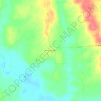
Name: Walnut Grove topographic map, elevation, terrain.
Location: Walnut Grove, Smith County, Texas, United States (32.15655 -95.27578 32.19655 -95.23578)
Average elevation: 430 ft
Minimum elevation: 328 ft
Maximum elevation: 600 ft
Smith County trails, hiking, mountain biking, running and outdoor activities
Other topographic maps
Click on a map to view its topography, its elevation and its terrain.