Geolocate

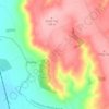
Sudbrooke topographic map

Click on the map to display elevation.

About this map

Name: Sudbrooke topographic map, elevation, terrain.

Location: Sudbrooke, West Lindsey, Lincolnshire, England, LN2 2SQ, United Kingdom (53.24839 -0.46651 53.28839 -0.42651)

Average elevation: 56 ft

Minimum elevation: 16 ft

Maximum elevation: 108 ft

Other topographic maps

Click on a map to view its topography, its elevation and its terrain.

Scotton CP

United Kingdom > England > Lincolnshire > West Lindsey

Average elevation: 59 ft

Linwood CP

United Kingdom > England > Lincolnshire > West Lindsey

Average elevation: 105 ft

Welton CP

United Kingdom > England > Lincolnshire > West Lindsey

The parish stretches from the ancient Ermine Street (A15) in the west, following a north-easterly shape to the Barlings Eau at its eastern end, of which the Welton Beck is a tributary, and is an example of a strip parish. Due to the low, flat topography of Lincolnshire, land had to be drained for agriculture…

Average elevation: 89 ft
Heapham CP

United Kingdom > England > Lincolnshire > West Lindsey

Average elevation: 62 ft

Kexby CP

United Kingdom > England > Lincolnshire > West Lindsey

Average elevation: 56 ft

Hemswell CP

United Kingdom > England > Lincolnshire > West Lindsey

Average elevation: 148 ft

Keelby CP

United Kingdom > England > Lincolnshire > West Lindsey

Average elevation: 89 ft

Brookenby CP

United Kingdom > England > Lincolnshire > West Lindsey

Average elevation: 279 ft

Bigby CP

United Kingdom > England > Lincolnshire > West Lindsey

Average elevation: 108 ft

Scotter CP

United Kingdom > England > Lincolnshire > West Lindsey

Average elevation: 49 ft

Grasby CP

United Kingdom > England > Lincolnshire > West Lindsey

Average elevation: 138 ft

Apley CP

United Kingdom > England > Lincolnshire > West Lindsey

Average elevation: 46 ft

Bardney CP

United Kingdom > England > Lincolnshire > West Lindsey

Average elevation: 26 ft

Stow CP

United Kingdom > England > Lincolnshire > West Lindsey

Average elevation: 43 ft

Riseholme CP

United Kingdom > England > Lincolnshire > West Lindsey

Average elevation: 167 ft

Saxilby

United Kingdom > England > Lincolnshire > West Lindsey

Average elevation: 30 ft

Scampton CP

United Kingdom > England > Lincolnshire > West Lindsey

Average elevation: 108 ft

Thoresway CP

United Kingdom > England > Lincolnshire > West Lindsey

Average elevation: 354 ft

Welton

United Kingdom > England > Lincolnshire > West Lindsey

Average elevation: 72 ft

Osgodby CP

United Kingdom > England > Lincolnshire > West Lindsey

Average elevation: 79 ft

Sixhills CP

United Kingdom > England > Lincolnshire > West Lindsey

Average elevation: 282 ft

Owmby CP

United Kingdom > England > Lincolnshire > West Lindsey

Average elevation: 82 ft

Reepham CP

United Kingdom > England > Lincolnshire > West Lindsey

Average elevation: 59 ft

Claxby CP

United Kingdom > England > Lincolnshire > West Lindsey

Average elevation: 266 ft

Hackthorn CP

United Kingdom > England > Lincolnshire > West Lindsey

Average elevation: 108 ft

Ingham CP

United Kingdom > England > Lincolnshire > West Lindsey

Average elevation: 128 ft

Upton CP

United Kingdom > England > Lincolnshire > West Lindsey

Average elevation: 62 ft

Brattleby CP

United Kingdom > England > Lincolnshire > West Lindsey

Average elevation: 115 ft

Blyton CP

United Kingdom > England > Lincolnshire > West Lindsey

Average elevation: 56 ft

Welton CP

United Kingdom > England > Lincolnshire > West Lindsey

The parish stretches from the ancient Ermine Street (A15) in the west, following a north-easterly shape to the Barlings Eau at its eastern end, of which the Welton Beck is a tributary, and is an example of a strip parish. Due to the low, flat topography of Lincolnshire, land had to be drained for agriculture…

Average elevation: 89 ft

Ingham CP

United Kingdom > England > Lincolnshire > West Lindsey

Average elevation: 128 ft

Bardney CP

United Kingdom > England > Lincolnshire > West Lindsey

Average elevation: 26 ft

Gear up for your next adventure:

📌Outdoor GPS Map App - Apps and devices for digital topographic navigation
🔋Solar Power Banks - Keep your GPS and phone charged in remote wilderness areas
👓Polarized Sunglasses - Outdoor sunglasses for glare reduction
🌧️Backpack Rain Cover - Keep gear dry in wet weather
🔭Telescopic Hiking Pole - Adjustable pole for hiking stability

As an Amazon Associate, this site earns from qualifying purchases at no extra cost to you.