Geolocate

Grad Popovača topographic map

Click on the map to display elevation.

About this map

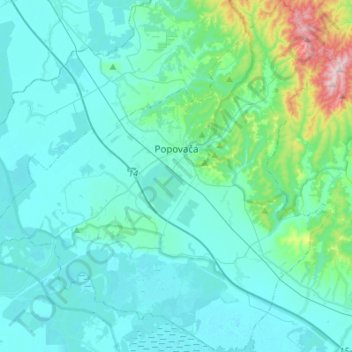
Name: Grad Popovača topographic map, elevation, terrain.

Location: Grad Popovača, Sisak-Moslavina County, Croatia (45.46036 16.47869 45.65183 16.74861)

Average elevation: 443 ft

Minimum elevation: 282 ft

Maximum elevation: 1,572 ft

Gear up for your next adventure:

📶Vehicle Signal Boosters - Improve reception in rural areas while driving to trailheads
🩳Quick‑Dry Hiking Shorts - Comfortable and quick‑dry shorts for summer hiking
🎒Outdoor Daypacks - Lightweight backpacks designed for carrying maps and essential gear
🔊Portable Camp Speaker - Music and alerts at camp
🪓Survival Multi‑Tool - Versatile tool for camp and trail tasks

As an Amazon Associate, this site earns from qualifying purchases at no extra cost to you.