Geolocate

Bemis topographic map

Click on the map to display elevation.

About this map

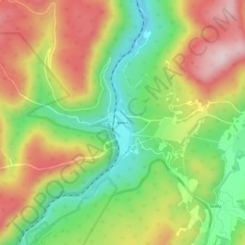
Name: Bemis topographic map, elevation, terrain.

Location: Bemis, Randolph County, West Virginia, 26268, United States (38.79205 -79.75895 38.83205 -79.71895)

Average elevation: 3,143 ft

Minimum elevation: 2,480 ft

Maximum elevation: 3,901 ft

Randolph County trails, hiking, mountain biking, running and outdoor activities

Other topographic maps

Click on a map to view its topography, its elevation and its terrain.

Montrose

United States > West Virginia > Randolph County

Average elevation: 2,067 ft

Gear up for your next adventure:

🌄Hiking Binoculars - Compact binoculars for scenic views and trail spotting
🏫Relief Map Kits - Hands-on tools for teaching landforms and elevation
🛶Inflatable Kayak - Portable kayak for rivers, lakes, and expeditions
🧦Merino Wool Socks - Moisture-wicking, blister-preventing socks for long treks
🗺️NatGeo Topo Maps - High-quality waterproof printed topographic maps of US Parks

As an Amazon Associate, this site earns from qualifying purchases at no extra cost to you.