Geolocate

Wakefield topographic map

Click on the map to display elevation.

About this map

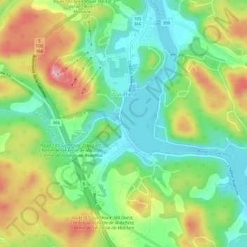
Name: Wakefield topographic map, elevation, terrain.

Location: Wakefield, La Pêche, Les Collines-de-l'Outaouais, Outaouais, Quebec, Canada (45.61854 -75.94520 45.65314 -75.91626)

Average elevation: 495 ft

Minimum elevation: 308 ft

Maximum elevation: 781 ft

Other topographic maps

Click on a map to view its topography, its elevation and its terrain.

Alcove

Canada > Quebec > Les Collines-de-l'Outaouais > La Pêche

Average elevation: 463 ft

Rupert

Canada > Quebec > Les Collines-de-l'Outaouais > La Pêche

Average elevation: 614 ft

Duclos

Canada > Quebec > Les Collines-de-l'Outaouais > La Pêche

Average elevation: 640 ft

Gear up for your next adventure:

📷Action Cameras - Rugged cameras to document your journeys across rugged terrain
🧥Men's Rain Shells - Premium waterproof and breathable jackets for mountain weather
📱Solar Portable Charger - Solar power bank for charging devices off‑grid
📶Satellite Messenger - Communication device off‑grid
🔥Plasma Lighters - Windproof lighters that work in any weather condition

As an Amazon Associate, this site earns from qualifying purchases at no extra cost to you.