
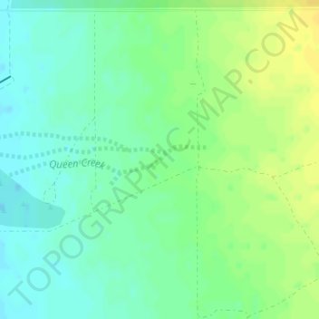
Queen Creek topographic map
Interactive map
Click on the map to display elevation.
About this map
Name: Queen Creek topographic map, elevation, terrain.
Location: Queen Creek, Pinal County, Arizona, United States (33.23603 -111.48019 33.23715 -111.47844)
Average elevation: 1,614 ft
Minimum elevation: 1,581 ft
Maximum elevation: 1,654 ft
Pinal County trails, hiking, mountain biking, running and outdoor activities
Other topographic maps
Click on a map to view its topography, its elevation and its terrain.
San Manuel
United States > Arizona > Pinal County
San Manuel is located at 32°36′18″N 110°38′0″W / 32.60500°N 110.63333°W / 32.60500; -110.63333 (32.605048, -110.633340), in the San Pedro River Valley at an elevation of about 3,500 feet (1,100 m). San Manuel is approximately 45 miles (72 km) northeast of Tucson.
Average elevation: 3,251 ft
Arizona City
United States > Arizona > Pinal County
Arizona City itself is mostly flat, lying in the Santa Cruz Valley in the center of three low mountain ranges; the Sawtooth Mountains to the south, the Picacho Mountains to the east, and the Casa Grande Mountains to the north. Picacho Peak, a prominent peak with a summit elevation of 3,374 feet (1,028 m), is…
Average elevation: 1,506 ft
Superior
United States > Arizona > Pinal County
Superior has a hot semi-arid climate. In January, the average high temperature is 61 °F (16 °C) with a low of 43 °F (6 °C). In July, the average high temperature is 98 °F (37 °C) with a low of 76 °F (24 °C). Annual precipitation is just over 18 inches, but is higher at greater altitudes. Despite its…
Average elevation: 3,146 ft
Biosphere 2 Research Center
United States > Arizona > Pinal County
The glass and spaceframe facility is located in Oracle, Arizona at the base of the Santa Catalina Mountains, about 50 minutes north of Tucson. Its elevation is around 4,000 feet (1,200 m) above sea level.
Average elevation: 3,802 ft
Apache Junction
United States > Arizona > Pinal County > Apache Junction > Apache Junction
Average elevation: 1,719 ft