
Make a donation
Gear up for your next adventure:
As an Amazon Associate, this site earns from qualifying purchases at no extra cost to you.
Nij Beets topographic map
Click on the map to display elevation.
Make a donation
Gear up for your next adventure:
As an Amazon Associate, this site earns from qualifying purchases at no extra cost to you.
Nij Beets
Ongeveer rond 1900 werd de nieuwe kern in de volksmond aangeduid als Nieuw Beets omdat de PTT deze naam hanteerde. Die situatie bleef, ook toen op 1 augustus 1925 Beets (Oud Beets), opging in Beetsterzwaag. Naar aanleiding van een verzoek van Plaatselijk Belang kwam de naam van het nieuwe Beets op de politieke agenda. Met 13 stemmen vóór en 4 tegen koos de gemeenteraad van Opsterland voor de naam Nij Beets. De door Plaatselijk Belang gewenste naam Nieuw Beets haalde het niet. Tot halverwege de jaren 1920 bleef op topografische kaarten de naam Beets gebruikt worden, en werd de plaats Nieuw/Nij Beets nog niet ingetekend.
Make a donation
Gear up for your next adventure:
As an Amazon Associate, this site earns from qualifying purchases at no extra cost to you.
About this map
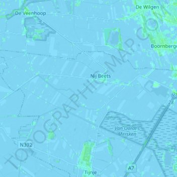
Name: Nij Beets topographic map, elevation, terrain.
Location: Nij Beets, Opsterland, Fryslân, Nederland (53.04904 5.92758 53.08121 6.05105)
Average elevation: -3 ft
Minimum elevation: -20 ft
Maximum elevation: 16 ft
Make a donation
Gear up for your next adventure:
As an Amazon Associate, this site earns from qualifying purchases at no extra cost to you.
Other topographic maps
Click on a map to view its topography, its elevation and its terrain.
Make a donation
Gear up for your next adventure:
As an Amazon Associate, this site earns from qualifying purchases at no extra cost to you.
Make a donation
Gear up for your next adventure:
As an Amazon Associate, this site earns from qualifying purchases at no extra cost to you.
Make a donation
Gear up for your next adventure:
As an Amazon Associate, this site earns from qualifying purchases at no extra cost to you.
Laaxum
In 1718 stonden er acht huizen in de buurtschap en in 1851 zes. Aan het begin van de twintigste eeuw was Laaxum een plaats met zestien huizen en twee boerderijen, waarin samen meer dan honderd mensen woonden. In het begin van de eenentwintigste stonden er elf huizen en één boerderij. De haven werd ook wel…
Average elevation: 0 ft
Make a donation
Gear up for your next adventure:
As an Amazon Associate, this site earns from qualifying purchases at no extra cost to you.
Make a donation
Gear up for your next adventure:
As an Amazon Associate, this site earns from qualifying purchases at no extra cost to you.
Make a donation
Gear up for your next adventure:
As an Amazon Associate, this site earns from qualifying purchases at no extra cost to you.
Make a donation
Gear up for your next adventure:
As an Amazon Associate, this site earns from qualifying purchases at no extra cost to you.
Make a donation
Gear up for your next adventure:
As an Amazon Associate, this site earns from qualifying purchases at no extra cost to you.
Make a donation
Gear up for your next adventure:
As an Amazon Associate, this site earns from qualifying purchases at no extra cost to you.
Skilleard
Schillaard werd in 1445 vermeld als Scallaert, in 1478 als Schillaerdt, in 1482 als Schellart en in 16e en 17e eeuw als Schillaerd. De plaatsnaam zou mogelijk verwijzen naar een terp (werth) bij een schelpenbank (skil-schelp). Een andere mogelijke betekenis is dat de terp/wierde scheef weglopend was, waarbij…
Average elevation: 0 ft
Make a donation
Gear up for your next adventure:
As an Amazon Associate, this site earns from qualifying purchases at no extra cost to you.