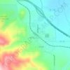
Kirk topographic map
Click on the map to display elevation.
About this map

Name: Kirk topographic map, elevation, terrain.
Location: Kirk, Lawrence County, South Dakota, 55754, United States (44.32304 -103.81353 44.36304 -103.77353)
Average elevation: 5,620 ft
Minimum elevation: 4,888 ft
Maximum elevation: 6,614 ft
Other topographic maps
Click on a map to view its topography, its elevation and its terrain.
Spearfish
United States > South Dakota > Lawrence County
Extreme winter maxima in the district are remarkably warm given the latitude and altitude; on January 19, 1921 Spearfish reached a temperature of 79 °F (26 °C), the hottest January temperature in South Dakota on record.
Average elevation: 3,845 ft
Deadwood
United States > South Dakota > Lawrence County
Deadwood is characterized by its rugged terrain nestled within the Black Hills region, boasting an elevation of approximately 4,531 feet. The town itself is set in a steep, narrow gulch surrounded by densely forested hills, which create a dramatic landscape of rolling hills and rocky outcrops. The topography…
Average elevation: 4,957 ft
Lead
United States > South Dakota > Lawrence County
Its high elevation in the Black Hills makes Lead one of the wettest places in South Dakota and among the snowiest places in the contiguous United States with a mean snowfall of 183.9 inches or 4.67 metres. During the cold and snowy winter of 1993–94, a whopping 364.7 inches (9.26 m) of snow fell and three…
Average elevation: 5,266 ft


Mountain Plains
United States > South Dakota > Lawrence County > Mountain Plains
Average elevation: 4,101 ft
Lead
United States > South Dakota > Lawrence County
Its high elevation in the Black Hills makes Lead one of the wettest places in South Dakota and among the snowiest places in the contiguous United States with a mean snowfall of 183.9 inches or 4.67 metres. During the cold and snowy winter of 1993–94, a whopping 364.7 inches (9.26 m) of snow fell and three…
Average elevation: 5,266 ft

Spearfish
United States > South Dakota > Lawrence County
Extreme winter maxima in the district are remarkably warm given the latitude and altitude; on January 19, 1921, Spearfish reached a temperature of 79 °F (26 °C), the hottest January temperature in South Dakota on record.
Average elevation: 3,845 ft