
睦岗街道 topographic map
Interactive map
Click on the map to display elevation.
About this map
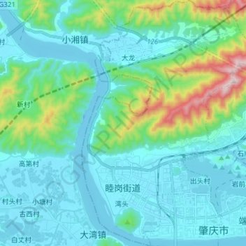
Name: 睦岗街道 topographic map, elevation, terrain.
Location: 睦岗街道, 端州区, 肇庆市, 广东省, 中国 (23.04238 112.39392 23.15622 112.47824)
Average elevation: 400 ft
Minimum elevation: -49 ft
Maximum elevation: 2,388 ft
Other topographic maps
Click on a map to view its topography, its elevation and its terrain.