
Make a donation
Gear up for your next adventure:
As an Amazon Associate, this site earns from qualifying purchases at no extra cost to you.
Tworog topographic map
Click on the map to display elevation.
Make a donation
Gear up for your next adventure:
As an Amazon Associate, this site earns from qualifying purchases at no extra cost to you.
About this map
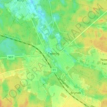
Name: Tworog topographic map, elevation, terrain.
Average elevation: 827 ft
Minimum elevation: 778 ft
Maximum elevation: 873 ft
Make a donation
Gear up for your next adventure:
As an Amazon Associate, this site earns from qualifying purchases at no extra cost to you.
Other topographic maps
Click on a map to view its topography, its elevation and its terrain.
Georgenberg
Polen > Woiwodschaft Schlesien > powiat tarnogórski
Um 1530 wurden in den Tarnowitzer Höhen im Herzogtum Beuthen reiche Silber- und Bleilagerstätten entdeckt. Auf den Fluren von Groß Zyglin (Żyglin) wurde nahe der Straße von Tarnowitz nach Tschenstochau ein Bergwerk errichtet, bei dem eine Ansiedlung der Bergleute entstand.
Average elevation: 948 ft
Georgenberg
Polen > Woiwodschaft Schlesien > powiat tarnogórski
Die Gemeinde liegt direkt an der Grenze zu Böhmen im Naturpark Oberpfälzer Wald, der Höhen bis 700 m erreicht. Die tschechische Nachbargemeinden sind Lesná und Česká Ves (früher Böhmischdorf).
Average elevation: 958 ft
Make a donation
Gear up for your next adventure:
As an Amazon Associate, this site earns from qualifying purchases at no extra cost to you.