
Monikie topographic map
Click on the map to display elevation.
About this map
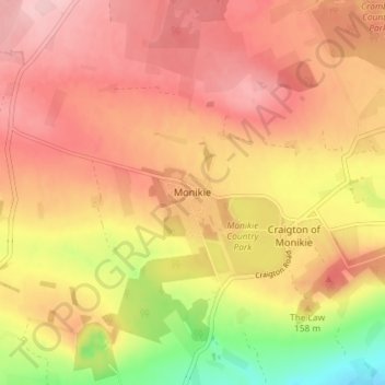
Name: Monikie topographic map, elevation, terrain.
Location: Monikie, Angus, Scotland, DD5 3QR, United Kingdom (56.51796 -2.83492 56.55796 -2.79492)
Average elevation: 486 ft
Minimum elevation: 151 ft
Maximum elevation: 676 ft
Other topographic maps
Click on a map to view its topography, its elevation and its terrain.