Geolocate

Bure topographic map

Click on the map to display elevation.

About this map

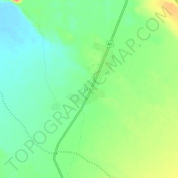
Name: Bure topographic map, elevation, terrain.

Location: Bure, Zone 1, Afar Region, Ethiopia (12.58097 42.24984 12.62097 42.28984)

Average elevation: 1,670 ft

Minimum elevation: 1,591 ft

Maximum elevation: 1,801 ft

Other topographic maps

Click on a map to view its topography, its elevation and its terrain.

Zone 4

Ethiopia > Afar Region

Average elevation: 2,871 ft

Danakil Depression

Ethiopia > Afar Region

Average elevation: 479 ft

water way

Ethiopia > Afar Region

Average elevation: 2,589 ft

Danakil Depression

Ethiopia > Afar Region

Average elevation: -344 ft

Zone 3

Ethiopia > Afar Region

Average elevation: 4,035 ft

Mille

Ethiopia > Afar Region > Lower Miele

Average elevation: 1,627 ft

Gear up for your next adventure:

⛑️Personal Locator Beacon - Safety beacon for emergencies
🥾Hiking Shoes - Durable and comfortable shoes for trail hiking
🌧️Backpack Rain Cover - Keep gear dry in wet weather
🔋Solar Power Banks - Keep your GPS and phone charged in remote wilderness areas
📡GPS Antenna Upgrade - Enhance GPS reception in remote terrain

As an Amazon Associate, this site earns from qualifying purchases at no extra cost to you.