Geolocate

Langdon topographic map

Click on the map to display elevation.

About this map

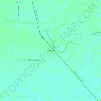
Name: Langdon topographic map, elevation, terrain.

Location: Langdon, Atchison County, Missouri, United States (40.33639 -95.59971 40.37639 -95.55971)

Average elevation: 889 ft

Minimum elevation: 876 ft

Maximum elevation: 899 ft

Atchison County trails, hiking, mountain biking, running and outdoor activities

Other topographic maps

Click on a map to view its topography, its elevation and its terrain.

Tarkio

United States > Missouri > Atchison County

Average elevation: 958 ft

Fairfax

United States > Missouri > Atchison County

Average elevation: 938 ft

Westboro

United States > Missouri > Atchison County

Average elevation: 1,033 ft

Watson

United States > Missouri > Atchison County

Average elevation: 902 ft

Nishnabotna

United States > Missouri > Atchison County

Average elevation: 961 ft

Gear up for your next adventure:

🔥Plasma Lighters - Windproof lighters that work in any weather condition
🧣Hiking Neck Gaiter - Multi‑use neck protection for outdoor weather
🧢Outdoor Hiking Hat - Sun protection hat for outdoor explorers
📷Action Cameras - Rugged cameras to document your journeys across rugged terrain
💧Water Purification System - Clean water on the trail with reliable purifiers

As an Amazon Associate, this site earns from qualifying purchases at no extra cost to you.