Geolocate

Don Fernandu topographic map

Click on the map to display elevation.

About this map

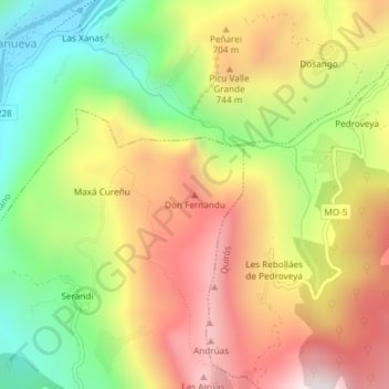
Name: Don Fernandu topographic map, elevation, terrain.

Location: Don Fernandu, Proaza, Asturias, 33115, Spain (43.26332 -5.98327 43.26342 -5.98317)

Average elevation: 1,916 ft

Minimum elevation: 525 ft

Maximum elevation: 3,323 ft

Other topographic maps

Click on a map to view its topography, its elevation and its terrain.

Proaza

Spain > Asturias > Proaza

Average elevation: 2,674 ft

Gear up for your next adventure:

🧭GPS Watch Accessories - Bands and chargers for GPS watches
🧭Pro Hiking Compasses - High-accuracy liquid-filled compasses for topographic orientation
🚪Portable Camp Chair - Foldable chair for comfort at camp
🕶️Glacier Sunglasses - Side shields to protect eyes from high-altitude snow glare
🌐World Map Poster - Decorative world maps with topographic info

As an Amazon Associate, this site earns from qualifying purchases at no extra cost to you.