Geolocate

Proaza topographic map

Click on the map to display elevation.

About this map

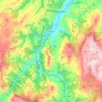
Name: Proaza topographic map, elevation, terrain.

Location: Proaza, Asturias, Spain (43.16754 -6.10464 43.28757 -5.97335)

Average elevation: 2,674 ft

Minimum elevation: 512 ft

Maximum elevation: 5,571 ft

Other topographic maps

Click on a map to view its topography, its elevation and its terrain.

Don Fernandu

Spain > Asturias > Proaza

Average elevation: 1,916 ft

Gear up for your next adventure:

🏕️Family Camping Gear - Essentials for group camping trips
🪶Compact Camp Shovel - Folding shovel for campsite tasks
🥄Camping Utensil Set - Lightweight utensils for outdoor meals
🏥Hiking First Aid Kits - Comprehensive medical kits for remote trail injuries
🌧️Backpack Rain Cover - Keep gear dry in wet weather

As an Amazon Associate, this site earns from qualifying purchases at no extra cost to you.