
Kambja vald topographic map
Interactive map
Click on the map to display elevation.
About this map
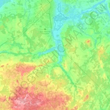
Name: Kambja vald topographic map, elevation, terrain.
Location: Kambja vald, Tartu maakond, Estonia (58.12155 26.51385 58.37549 26.86620)
Average elevation: 256 ft
Minimum elevation: 92 ft
Maximum elevation: 617 ft
Other topographic maps
Click on a map to view its topography, its elevation and its terrain.