
Elva vald topographic map
Interactive map
Click on the map to display elevation.
About this map
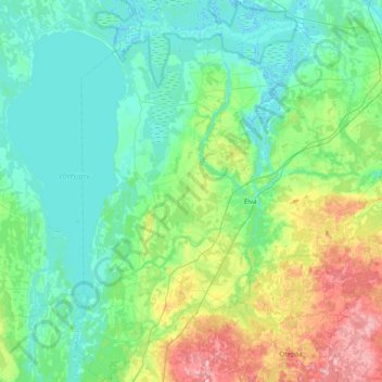
Name: Elva vald topographic map, elevation, terrain.
Location: Elva vald, Tartu maakond, Estonia (58.02768 26.05201 58.43934 26.51945)
Average elevation: 223 ft
Minimum elevation: 98 ft
Maximum elevation: 702 ft
Other topographic maps
Click on a map to view its topography, its elevation and its terrain.