
Guadalupe Victoria topographic map
Interactive map
Click on the map to display elevation.
About this map
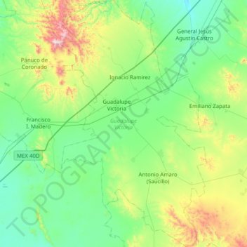
Name: Guadalupe Victoria topographic map, elevation, terrain.
Location: Guadalupe Victoria, Durango, México (24.11772 -104.26696 24.68352 -103.89593)
Average elevation: 6,814 ft
Minimum elevation: 5,974 ft
Maximum elevation: 9,862 ft
Other topographic maps
Click on a map to view its topography, its elevation and its terrain.
Guadalupe Victoria
México > Durango > Guadalupe Victoria > Guadalupe Victoria
Guadalupe Victoria, Durango, México
Average elevation: 6,578 ft
Ignacio Ramirez
México > Durango > Guadalupe Victoria > Ignacio Ramirez
Ignacio Ramirez, Guadalupe Victoria, Durango, México
Average elevation: 6,686 ft