
Faro topographic map
Interactive map
Click on the map to display elevation.
About this map
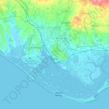
Name: Faro topographic map, elevation, terrain.
Location: Faro, Algarve, Portugal (36.96171 -7.97662 37.08110 -7.80540)
Average elevation: 56 ft
Minimum elevation: -16 ft
Maximum elevation: 449 ft
Other topographic maps
Click on a map to view its topography, its elevation and its terrain.