Geolocate

Roden topographic map

Click on the map to display elevation.

About this map

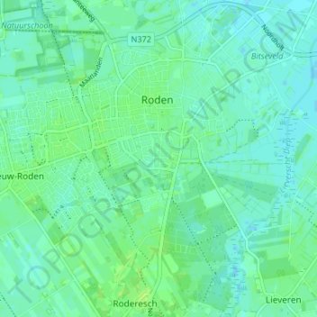
Name: Roden topographic map, elevation, terrain.

Location: Roden, Noordenveld, Drenthe, Netherlands (53.11346 6.39370 53.15273 6.46012)

Average elevation: 16 ft

Minimum elevation: 0 ft

Maximum elevation: 36 ft

Other topographic maps

Click on a map to view its topography, its elevation and its terrain.

Hondsrug

Netherlands > Drenthe > Exloo

Average elevation: 62 ft

Zuidbarge

Netherlands > Drenthe > Emmen

Average elevation: 66 ft

Lhee

Netherlands > Drenthe

Average elevation: 36 ft

Gear up for your next adventure:

📷Action Cameras - Rugged cameras to document your journeys across rugged terrain
🧭Map Reading Tools - Tools and kits for map navigation
🧭GPS Watch Accessories - Bands and chargers for GPS watches
🔥Fast-Boil Camping Stoves - Efficient cooking systems for quick trail meals
🛠️Backpacking Tool Kit - Essential toolkit for outdoor repairs

As an Amazon Associate, this site earns from qualifying purchases at no extra cost to you.