Geolocate

Lhee topographic map

Click on the map to display elevation.

About this map
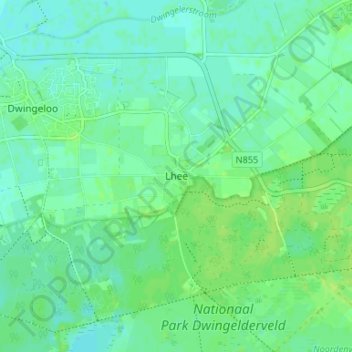
Name: Lhee topographic map, elevation, terrain.

Location: Lhee, Dwingeloo, Westerveld, Drenthe, Netherlands, 7991 PK, Netherlands (52.80558 6.37398 52.84558 6.41398)

Average elevation: 36 ft

Minimum elevation: 20 ft

Maximum elevation: 56 ft

Other topographic maps

Click on a map to view its topography, its elevation and its terrain.

Veenoord

Netherlands > Drenthe

Average elevation: 46 ft

Rhee

Netherlands > Drenthe > Assen

Average elevation: 39 ft

Meppel

Netherlands > Drenthe

Average elevation: 7 ft

Assen

Netherlands > Drenthe

Average elevation: 39 ft

Annerveenschekanaal

Netherlands > Drenthe

Average elevation: 7 ft

Norg

Netherlands > Drenthe

Average elevation: 26 ft

Odoorn

Netherlands > Drenthe

Average elevation: 72 ft

Elp

Netherlands > Drenthe

Average elevation: 59 ft

Amen

Netherlands > Drenthe

Average elevation: 52 ft

Gieten

Netherlands > Drenthe

Average elevation: 39 ft

Beilen

Netherlands > Drenthe

Average elevation: 46 ft

Spier

Netherlands > Drenthe

Average elevation: 46 ft

Midlaren

Netherlands > Drenthe

Average elevation: 13 ft

Wilhelminaoord

Netherlands > Drenthe

Average elevation: 16 ft

Roden

Netherlands > Drenthe

Average elevation: 16 ft

Tiendeveen

Netherlands > Drenthe

Average elevation: 49 ft

Emmer-Compascuum

Netherlands > Drenthe

Average elevation: 49 ft

Dwingeloo

Netherlands > Drenthe

Average elevation: 33 ft

Hoogersmilde

Netherlands > Drenthe

Average elevation: 39 ft

Coevorden

Netherlands > Drenthe

Average elevation: 49 ft

Coevorden

Netherlands > Drenthe > Coevorden

Average elevation: 36 ft

Erica

Netherlands > Drenthe

Average elevation: 56 ft

Ees

Netherlands > Drenthe

Average elevation: 59 ft

Schipborg

Netherlands > Drenthe

Average elevation: 26 ft

Havelte

Netherlands > Drenthe

Average elevation: 16 ft

Zuidlaren

Netherlands > Drenthe

Average elevation: 16 ft

Erica

Netherlands > Drenthe

Average elevation: 56 ft

Assen

Netherlands > Drenthe

Average elevation: 39 ft

Annerveenschekanaal

Netherlands > Drenthe

Average elevation: 7 ft

Gear up for your next adventure:

🏥Hiking First Aid Kits - Comprehensive medical kits for remote trail injuries
🧤Tactile Hiking Gloves - Keep hands warm while operating GPS and smartphone screens
🦺Reflective Outdoor Gear - Safety gear for low‑light conditions
🪶Multi‑Purpose Knife - Useful blade for camp and trail
👖Convertible Hiking Pants - Versatile zip-off pants for changing altitudes and temperatures

As an Amazon Associate, this site earns from qualifying purchases at no extra cost to you.