
Port Orchard topographic map
Click on the map to display elevation.
About this map
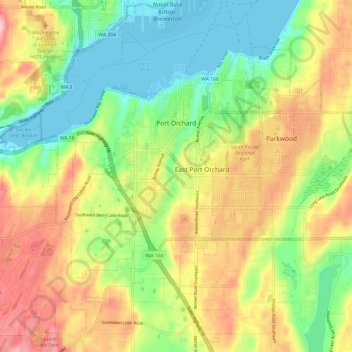
Name: Port Orchard topographic map, elevation, terrain.
Location: Port Orchard, Kitsap County, Washington, United States (47.48174 -122.72156 47.55692 -122.60203)
Average elevation: 233 ft
Minimum elevation: -10 ft
Maximum elevation: 531 ft
Kitsap County trails, hiking, mountain biking, running and outdoor activities
Other topographic maps
Click on a map to view its topography, its elevation and its terrain.
Seattle viewpoint
United States > Washington > Kitsap County > Bainbridge Island
Average elevation: 66 ft
Bremerton
United States > Washington > Kitsap County > Bremerton > Bremerton
Average elevation: 217 ft