Geolocate

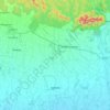
Janakpur topographic map

Click on the map to display elevation.

About this map

Name: Janakpur topographic map, elevation, terrain.

Location: Janakpur, Dhanusha, Madhesh Province, Nepal (26.56845 85.76490 26.88845 86.08490)

Average elevation: 266 ft

Minimum elevation: 187 ft

Maximum elevation: 469 ft

Other topographic maps

Click on a map to view its topography, its elevation and its terrain.
Dhanusadham

Nepal > Madhesh Province > Dhanusha

Average elevation: 466 ft

Gear up for your next adventure:

🚪Portable Camp Chair - Foldable chair for comfort at camp
💧Water Purification System - Clean water on the trail with reliable purifiers
🧥Men's Rain Shells - Premium waterproof and breathable jackets for mountain weather
🪶Trail Camera - Capture wildlife on your hikes
👟Men's Trail Runners - Lightweight footwear for fast-paced exploration and light hiking

As an Amazon Associate, this site earns from qualifying purchases at no extra cost to you.