Geolocate

Hetzendorf topographic map

Click on the map to display elevation.

About this map

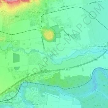
Name: Hetzendorf topographic map, elevation, terrain.

Location: Hetzendorf, Fohnsdorf, Bezirk Murtal, Styria, 8753, Austria (47.17203 14.66794 47.21203 14.70794)

Average elevation: 2,333 ft

Minimum elevation: 2,188 ft

Maximum elevation: 2,782 ft

Other topographic maps

Click on a map to view its topography, its elevation and its terrain.

Pölstal

Austria > Styria > Bezirk Murtal

Average elevation: 4,928 ft

Spielberg

Austria > Styria > Bezirk Murtal

Average elevation: 2,431 ft

Spielberg

Austria > Styria > Bezirk Murtal

Average elevation: 2,431 ft

St. Peter ob Judenburg

Austria > Styria > Bezirk Murtal

Average elevation: 3,839 ft

Judenburg

Austria > Styria > Bezirk Murtal

Average elevation: 3,356 ft

Gear up for your next adventure:

👖Convertible Hiking Pants - Versatile zip-off pants for changing altitudes and temperatures
🪵Folding Camp Saw - Compact saw for wood and campsite work
🔋Rechargeable Batteries - Power up your outdoor devices
🏕️Family Camping Gear - Essentials for group camping trips
🧤Hiking Gloves - Protective gloves for rugged trails

As an Amazon Associate, this site earns from qualifying purchases at no extra cost to you.