
Nelamangala topographic map
Click on the map to display elevation.
Nelamangala
{{Infobox settlement | name = Nelamangala | native_name = ನೆಲಮಂಗಲ | native_name_lang = kn | other_name = | nickname = | settlement_type = City | image_skyline = | image_alt = | image_caption = | pushpin_map = India Karnataka#India#Asia | pushpin_label_position = right | pushpin_map_alt = | pushpin_map_caption = Location in Karnataka, India | coordinates = 13°06′07″N 77°22′26″E / 13.102°N 77.374°E / 13.102; 77.374 | subdivision_type = Country | subdivision_name = India | subdivision_type1 = State | subdivision_name1 = Karnataka | subdivision_type2 = District | subdivision_name2 = Bangalore Rural | established_title = | established_date = | founder = | named_for = | government_type = Nagarasabha | governing_body = Nelamangala CMC | unit_pref = Metric | area_footnotes = | area_rank = 3 | area_total_km2 = 507 | elevation_footnotes = | elevation_m = 882 | population_total = 2,10,889 | population_as_of = 2011 | population_rank = 3rd Highest in Bangalore Rural | population_density_km2 = 415.95 | population_demonym = | population_footnotes = | demographics1_title1 = Official | demographics1_info1 = Kannada | timezone1 = IST | utc_offset1 = +5:30 | postal_code_type = PIN | postal_code = 562 123 | area_code_type = Telephone code | area_code = 08118 | registration_plate = KA-52 | website = | footnotes = | leader_party = [[Congress] | leader_title = Member of Legislative Assembly | leader_name = N Srinivas | population_est = 245624 | pop_est_as_of = 2021 | population_urban = 47799 | population_rural = 163090 }}
About this map
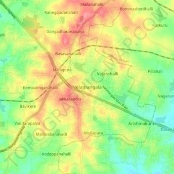
Name: Nelamangala topographic map, elevation, terrain.
Average elevation: 2,900 ft
Minimum elevation: 2,779 ft
Maximum elevation: 3,031 ft
Other topographic maps
Click on a map to view its topography, its elevation and its terrain.